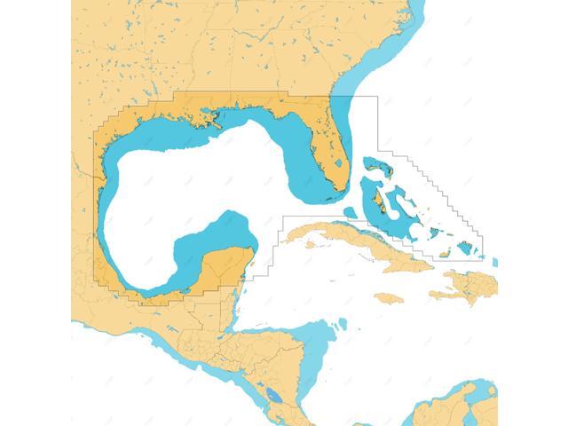
FULL-FEATURED VECTOR CHARTS: Offers straightforward navigation with precise, current vector chart details sourced from official Hydrographic Office data. HI-RES BATHYMETRY LAYER: Aids in locating shallow zones, drop-offs, ledges, holes, or humps. Contains high-resolution bathymetry data with integrated Genesis social map data. SUBSCRIPTION-FREE AUTOROUTING: Automatically calculates the shortest, safest path using detailed chart data and personalized vessel information. SHADED RELIEF: Animates the world with 3D rendered land and underwater elevation, incorporating areas of Ultra-High-Res Bathymetric imagery, perfect for anglers and divers. CUSTOM DEPTH SHADING: Enables setting a distinct safety depth, preserving a paper-like view, or generating custom shading. COMPATIBILITY: This chart is designed for the latest Simrad and B & G chartplotters running NEON. INSTALLATION: The product arrives programmed on a Micro-SD card placed in an SD adapter. Most chart plotters include a Micro SD card reader. To utilize this chart, take out the Micro-SD card from the SD adapter

![(3 Pack) Anti-Glare (Matte) Screen Protector Designed for 16 inch Laptop [2021-2024 Release]](https://c1.neweggimages.com/ProductImageCompressAll640/C5F4S26031109CI8K76.jpg)

![(50 GSM) 2-1/4 x 230' 1-Ply Thermal Paper [100 Rolls] Certified BPA Free Cash Register Tape](https://c1.neweggimages.com/ProductImageCompressAll640/C7YVD2607250N30MKF1.jpg)